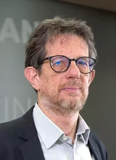
Keynote Speaker

Prof. Dr. Fabio Tosti
University of West London
IEEE Senior Member
Biography:
Fabio Tosti (IEEE M'17–SM'19) received the M.Sc. and Eng. degrees (cum laude) in Infrastructure and Transportation Engineering from Roma Tre University, Rome, Italy, in 2010, and the Ph.D. degree in Civil Engineering with European Doctorate Label (excellent rating) from Roma Tre University, in 2014. A registered Chartered Engineer, he is a Professor of Civil Engineering at the School of Computing and Engineering, University of West London (UWL), London, U.K., and the Director of “The Faringdon Research Centre for Non-Destructive Testing and Remote Sensing” at UWL. His research interests include the development of new algorithms, methodologies, and models for geoscience applications and the non-destructive and satellite remote sensing assessment, repair, and maintenance of civil and green infrastructure. He has authored/co-authored over 220 research publication records in international journals, conferences, and books and delivered numerous keynote and invited lectures. Prof. Tosti was a recipient of the ECSs Award by the European Geosciences Union (EGU) in 2017 and several Best Paper Awards at International Conferences, including the 2021 IEEE Asia–Pacific Conference on Geoscience, Electronics and Remote Sensing Technology (AGERS2021) and the IEEE 2020 43rd International Conference on Telecommunications and Signal Processing (TSP2020). He was the General Co-Chair of the 3rd and 2nd International Workshop on Signal Processing Techniques for Ground Penetrating Radar Applications in 2022 and 2020 (TSP—IEEE Conf. Record 49548), respectively, and he served as the main organiser, scientific committee member and chair of technical sessions in 50+ international conferences and workshops. He served as the managing guest editor for various journals. He is the Editor-in-Chief of NDT (MDPI), and an Associate Editor of the International Journal of Pavement Engineering (IJPE), Remote Sensing (MDPI), Frontiers in Remote Sensing, Geoscientific Instrumentation, Methods and Data Systems (GI), and the Journal of Railway Engineering.

Engineer, Francesco Cenci
Leonardo Innovation Labs
Biography:
Francesco Cenci received the MSc degree cum laude in Electronic Engineering, Informatics in 1988 at the University of Rome La Sapienza, with a thesis and a following scholarship on Artificial Intelligence and Logic programming at the Selenia (today Leonardo) AI Lab. From 1990, he worked at the Alenia IT Lab on Internet and Multimedia technologies, participating to joint research with the Media Lab of the MIT. Then, he was appointed Project Manager for new technologies in the Alenia Radar System Division. From 1998 to 2009, he was mobile VAS product manager, Marketing Operations Manager and Partner Manager in Ericsson. From 2009, he worked at SESM (Soluzioni Evolute per la Sistemistica e i Modelli, a Finmeccanica Company) with the role of Marketing, Sales and programs responsible. Since 2014 with the SESM incorporation in Selex ES (today Leonardo) he worked in the CTO department, first as Head of CTO for Air&Vessel Traffic Management Systems, then in the Electronics Division. Nowadays, he works in Leonardo Electronics at the Innovations and Digital Transformation Unit.

Dr. Pasquale Ferrara
Leonardo Innovation Labs
Biography:
Pasquale Ferrara received the MSc degree in Telecommunications Engineering and the PhD in Computer Science, Systems and Telecommunications in 2011 and 2015, respectively, from the University of Florence, Italy. From June 2011 to May 2013, he was a research assistant at the National Institute of Optics of the National Research Council (CNR), in Florence. From June 2013 to February 2016, he was a research assistant in the Department of Information Engineering, University of Florence. Then, from April 2016 to January 2022, he was a scientific project manager at the Joint Research Centre of the European Commission, Ispra, Italy. Since February 2022, he has been with Leonardo SpA as a senior researcher at the Leonardo Labs, the company’s research and innovation unit. His field of interest is in signal processing, with a focus on the application of artificial intelligence techniques.

Senior Researcher, Dr. Pietro Tizzani
Institute for Electromagnetic Sensing of the Environment (CNR-IREA)
Biography:
Dr. Pietro Tizzani is a Senior Researcher at the National Research Council (CNR) - Institute for Electromagnetic Sensing of the Environment (IREA) and serves as the Scientific Coordinator of the CNR - GAIA iLAB. He is also the President of the EGU - Geosciences Instrumentation and Data Systems (GI) Division. Holding a Ph.D. in Geophysics and Volcanology (2001) and a degree in Earth Sciences (1998) from Università degli Studi di Napoli - FEDERICO II, Dr. Tizzani has had a distinguished career, including research positions at the National Institute of Geophysics and Volcanology (INGV) and a fellowship with the Italian Space Agency (ASI) on the "Volcanic Risk System Pilot Project." His research emphasizes the integration of multiplatform remote sensing technologies for Earth Observation, combining satellite, UAV, and ground-based systems. Dr. Tizzani is a leader in using differential interferometry (InSAR) integrated with GPS, EDM, LiDAR, thermal imaging. In the last years is focused on integration of the magnetometry, ground-penetrating radar (GPR), and electro-magnetometry on UAV based-systems. His work has advanced the quantitative analysis of geodynamic processes in volcanic, seismogenic, and geothermal regions, as well as applications in agro-environmental and urban settings. Dr. Tizzani has contributed significantly to the study of active volcanic areas, including Campi Flegrei, Yellowstone, and Mauna Loa, focusing on their deformation and thermal state. His innovative monitoring techniques also extend to active seismo-tectonic regions and environmental hazards, employing LiDAR and photogrammetry to map landslides, floods, and subsidence phenomena. He has successfully led numerous national and international research projects, securing substantial funding and publishing extensively in ISI-indexed journals. Currently, he is actively engaged in planetary geosciences research at CNR, applying integrated remote sensing to study terrestrial analogs and extreme environments. This work bridges Earth Observation technologies and planetary science, expanding their applications to new scientific frontiers while maintaining a strong focus on technological integration across platforms.